Set across the rocky highlands of Boğazkale, Hattusa brings the Lower and Upper City, Büyükkale, fortification gates, temples, Yazılıkaya and cuneiform archives into one account of Hittite politics, belief and urban order.
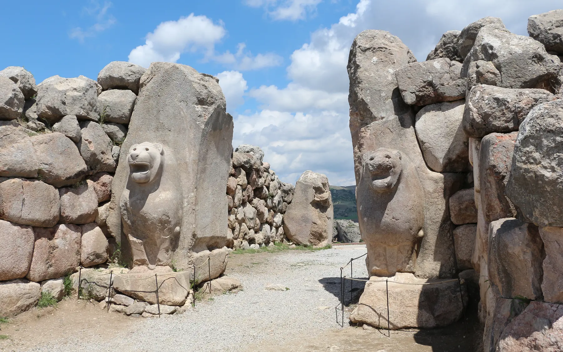
The Lion Gate at Hattusa, a monumental entrance on the south-western fortification line.Captured: 2014Photo: Bernard GagnonWikimedia Commons ↗CC BY-SA 3.0 ↗Cropped for web
Location
Boğazkale, Çorum
Chronology
Chalcolithic–Iron Age; capital c. 1650–1180 BCE
Research / protection
UNESCO World Heritage · 1986
WGS84 reference
40.0197° N · 34.6153° E
Research identity
Excavation and scientific lead
Systematic research begun in 1906 continues within the German Archaeological Institute's long-term Boğazköy programme in cooperation with the Ministry.
✓The institutional relationship is verified against official project and institution pages.
01
Evidence at a glance
01
Inscribed as World Heritage in 1986
02
Systematic excavation and research began in 1906
03
About seven kilometres of fortifications
04
Cuneiform archives are on UNESCO's Memory of the World Register
02
Read the site layer by layer
01
A capital shaped by rock and relief
The city stretches between the crag of Büyükkale and the Lower and Upper City. Its walls, Lion Gate, King's Gate and Yerkapı were more than defences: they staged the capital's ceremonial image through the terrain.
The Lion Gate at Hattusa, a monumental entrance on the south-western fortification line.Captured: 2014Photo: Bernard GagnonWikimedia Commons ↗CC BY-SA 3.0 ↗Cropped for web
02
Palace, administration and archives
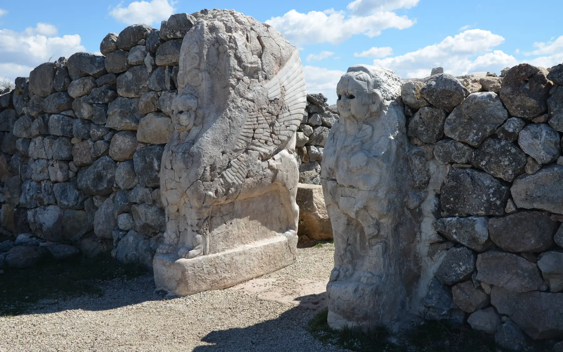
The palace precinct and tablet archives preserve treaties, letters, laws, rituals and records in several languages. Hittite government can therefore be studied through written administration as well as monumental architecture.
The Sphinx Gate above the Yerkapı rampart and its Hittite masonry.Captured: 2016Photo: Carole RaddatoWikimedia Commons ↗CC BY-SA 2.0 ↗Cropped for web
03
Temples and Yazılıkaya
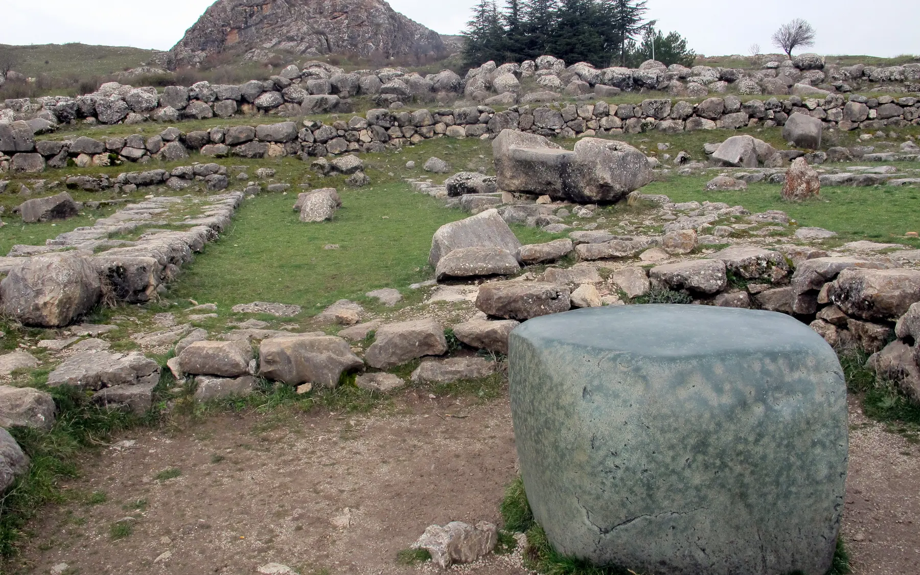
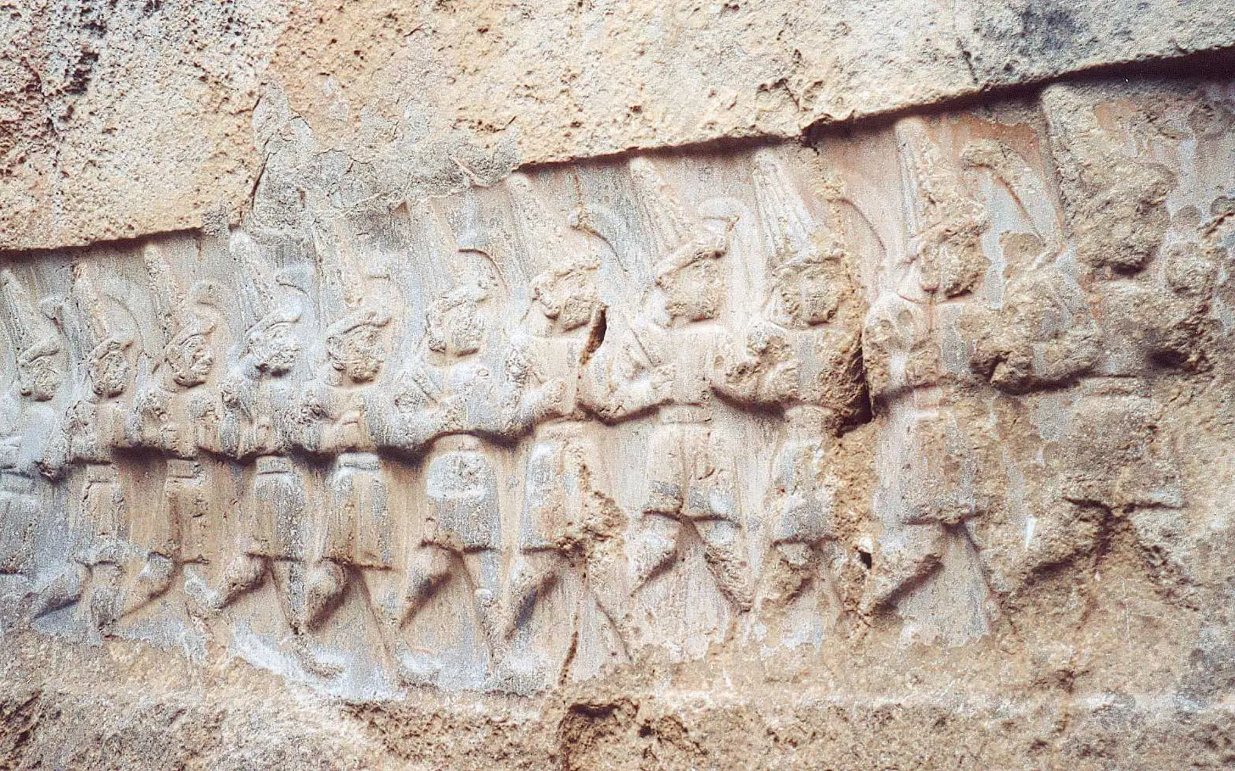
The Great Temple, the Upper City's temple district and the rock sanctuary of Yazılıkaya formed an exceptionally dense ritual landscape. Processions of deities show how the imperial pantheon was ordered and represented.
Remains of the Great Temple in the Lower City and the green stone.Captured: 2013Photo: Murat Özsoy 1958Wikimedia Commons ↗CC BY-SA 4.0 ↗Cropped for web
04
Excavation, recording and conservation
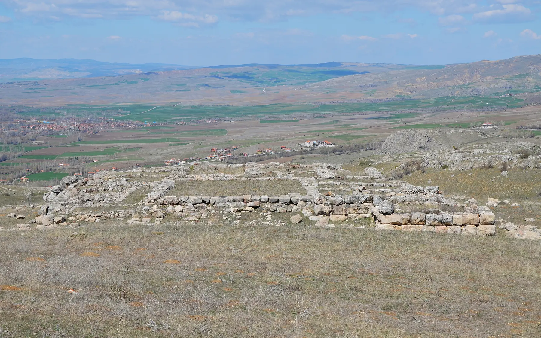
Systematic work began in 1906 and has continued within the German Archaeological Institute's long-term programme since 1931. Current research combines stratigraphy, architectural recording, archaeometry, environmental evidence and conservation.
The Upper City temple district at Hattusa within the Boğazkale landscape.Captured: 2016Photo: Carole RaddatoWikimedia Commons ↗CC BY-SA 2.0 ↗Cropped for web
05
Layers after the capital
The political breakdown around the early 12th century BCE did not make every form of occupation vanish at once. Iron Age and later traces show how the Boğazkale landscape was reused after the imperial capital ended.
Relief of the Twelve Gods in procession at the Yazılıkaya rock sanctuary.Captured: 2001Photo: China CrisisWikimedia Commons ↗CC BY-SA 2.5 ↗Cropped for web
Through an Archaeologist's Eye
What should you notice in the field?
◎
What deserves attention on site?
Read the gates through valleys, slopes and ceremonial axes rather than as isolated monuments.
≋
How should this layer be read?
Lower City, Büyükkale and Upper City were not one simultaneous plan; they preserve phases of growth and reorganisation.
△
What is the common misreading?
Representing Hattusa only through walls and gates hides its archives, temples and Yazılıkaya.
These boxes do not claim personal discoveries. They are field-reading questions grounded in published archaeological context. Verifiable original observations by Ersin İğde are added separately and explicitly labelled.
Field mode
Prepare the file before your visit
Save the page for offline use, open the coordinates, use the checklist and keep personal notes only on this device.
Notes are not sent to the server; they stay in this browser's local storage.
✦
Why does it matter?
Hattusa
Hattusa combines a monumental city, sacred landscape and state archive, making it the central place for reading the Hittite Empire through both material and written evidence.
Weekly currency system
Capital dossier added
Location, excavation history, World Heritage scope and institutional lead were aligned with DAI and UNESCO records.