Back to the Info Corner entrance

Info Corner · Archaeology

Archaeology

Explore selected excavation sites in Türkiye through detailed files covering chronology, field methods, finds, daily life and conservation.

9
Site files
4
Chronological filters
3
Publishing languages
Quick SwitchExport GuideA practical market-to-delivery roadmap
Prepared by Ersin İğdeLast editorial review: 3 August 2026Author and methodology

Read each place through chronology, fieldwork, trade networks, belief, daily life and conservation—not simply as a monument.

9 research files
Filter excavation sites9 / 9
Filter by period

Geographic reading

See every site in its correct context

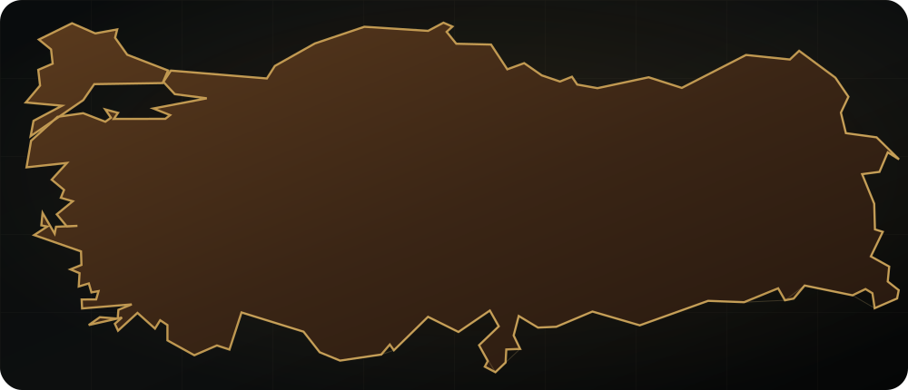
Compare nine research files using verified WGS84 reference points. Selecting a site updates the map, chronology and field dossier together.

The base map is simplified from Natural Earth country geometry. Markers use the WGS84 coordinate system.

Hittite stone foundations and remains of monumental architecture at Kayalıpınar.
Hittite stone foundations and remains of monumental architecture at Kayalıpınar.Captured: 2019Photo: Ingeborg SimonWikimedia CommonsCC BY-SA 3.0Cropped for web

Selected research file

Šamuha (Samuha)

Hittite cult and administrative centre on the Kızılırmak

8-minute read

On the north bank of the upper Kızılırmak, Kayalıpınar is a multi-period river settlement identified with ancient Šamuha through Old Assyrian exchange, Hittite monumental buildings and cuneiform tablets.

Site Profile
Kayalıpınar, Yıldızeli, Sivas
Reference location
39.6197° N · 36.5282° E
Chronology
Chalcolithic–Roman; especially Middle and Late Bronze Age
Protection / research
Active excavation · New phase since 2022

Research identity

Excavation and scientific lead

The new excavation phase at Kayalıpınar is led through Koç University ARHA, combining stratigraphy, monumental architecture and conservation.

The institutional relationship is verified against official project and institution pages.

02

Comparative reading

Examine excavation sites side by side

Select two or three sites and compare chronology, settlement, architecture, economy, finds, excavation method and conservation.

2/3 · Up to 3 sites
01

Bathonea

Ancient harbour and multi-layered settlement
Location
Lake Küçükçekmece, Istanbul
Chronology
Epipalaeolithic–Ottoman
Settlement type
Harbour and lagoon settlement
Architecture
Harbour works, water structures, workshops and basilical buildings
Economy
Coastal mobility, production, food processing and regional trade
Important finds
Stone finds, ceramics, and evidence for production and water systems
Excavation method
Basin-scale survey, stratigraphic excavation and environmental data
Conservation status
Active excavation; lagoon conditions and urban pressure are monitored together
02

Troy

A 4,000-year bridge between Anatolia and the Aegean
Location
Hisarlık, Çanakkale
Chronology
Bronze Age–Roman
Settlement type
Fortified tell settlement
Architecture
Superimposed walls, gates, megarons, ramp and sanctuaries
Economy
Straits traffic, Aegean–Anatolian exchange and regional production
Important finds
Bronze Age architectural phases, ceramics and defence systems
Excavation method
Microstratigraphy, building phases, geophysics and conservation-led excavation
Conservation status
UNESCO property; visitors, legacy excavation damage and conservation are managed together

03

Chronological context

Not one line, but a layered chronology

Compare each site's strongest research phases. The period filter narrows the map at the same time.

  1. 01
    10th–7th millennia BCEEarly experiments in settled life
  2. 02
    3rd–2nd millennia BCEBronze Age cities and networks
  3. 03
    4th–1st centuries BCEHellenistic kingdoms and urbanism
  4. 04
    1st–7th centuries CERoman and Late Antique change
  5. 05
    7th–19th centuries CEByzantine and Ottoman layers

04

Finds Atlas · First records

Keep every object in context

Each record connects an object or architectural feature to material, date, find context, current location, evidence source and image licence.

Where an inventory number or precise layer cannot be verified in open sources, the record says so explicitly.

05

Archaeology database · Version 1.1

Nine files in one extensible data model

Province, coordinates, period, site type, research institution, excavation/conservation status, UNESCO record, update date and official source share one record.

Download JSON datasetJSON · UTF-8 · 9 records
FileProvince / regionCoordinatesPeriodSite typeInstitutionStatusUNESCOLast updatedOfficial source
BathoneaIstanbul · Marmara41.021° N · 28.718° EEpipalaeolithic–OttomanSettlement / tellScientific direction by Kocaeli UniversityActive excavationNot a UNESCO World Heritage propertyOfficial source
TroyÇanakkale · North Aegean39.958° N · 26.239° EBronze Age–RomanSettlement / tellMinistry of Culture and Tourism / Troy MuseumUNESCO World Heritage · 1998World Heritage · 1998Official source
Pergamonİzmir · Aegean39.133° N · 27.185° EHellenistic–OttomanCity / cultural landscapeGerman Archaeological Institute / Ministry of Culture and TourismUNESCO World Heritage · 2014World Heritage · 2014Official source
Ephesusİzmir · Aegean37.939° N · 27.341° ENeolithic–OttomanCity / cultural landscapeAustrian Archaeological Institute / Ministry of Culture and TourismUNESCO World Heritage · 2015World Heritage · 2015Official source
Stone HillsŞanlıurfa · Southeastern AnatoliaŞanlıurfa bölgesel odakc. 9600–8000 BCERegional research networkStone Hills Project / Ministry of Culture and TourismMulti-site research programmeGöbeklitepe World Heritage · 2018; not the whole programmeOfficial source
HattusaÇorum · Central Anatolia40.0197° N · 34.6153° EChalcolithic–Iron Age; capital c. 1650–1180 BCECity / cultural landscapeGerman Archaeological Institute / Ministry of Culture and TourismUNESCO World Heritage · 1986World Heritage · 1986Official source
Šarišša (Sarissa)Sivas · Central Anatolia39.3083° N · 36.9097° E16th–13th centuries BCE; Iron Age layersSettlement / tellPhilipps-Universität Marburg / Sivas MuseumResearch programme since 1992Not a UNESCO World Heritage propertyOfficial source
Šamuha (Samuha)Sivas · Central Anatolia39.6197° N · 36.5282° EChalcolithic–Roman; especially Middle and Late Bronze AgeSettlement / tellKoç University / Ministry of Culture and TourismActive excavation · New phase since 2022Not a UNESCO World Heritage propertyOfficial source
NerikSamsun · Black Sea41.2076° N · 35.4299° EChalcolithic–Medieval; especially Middle and Late Bronze AgeSettlement / tellOymaağaç Höyük–Nerik Excavation Project / inter-university teamActive excavation · Since 2007Not a UNESCO World Heritage propertyOfficial source

04

Research dossier

Evidence at a glance

01

The first cuneiform tablet was found in 1999

02

Systematic excavation began in 2005

03

A new excavation phase has continued since 2022

04

Tablets support the Kayalıpınar–Šamuha identification

05

Field note

A layer-by-layer reading

  1. 01

    River crossing and regional network

    Kayalıpınar's position on the Kızılırmak was decisive for a centre controlling routes through the Upper Land. The river was not only a boundary; it was a corridor for people, materials and information.

    The Kayalıpınar settlement area within the upper Kızılırmak landscape.
    The Kayalıpınar settlement area within the upper Kızılırmak landscape.Captured: 2019Photo: Ingeborg SimonWikimedia CommonsCC BY-SA 3.0Cropped for web
  2. 02

    Old Assyrian trading layers

    Middle Bronze Age levels provide evidence for the commercial world connected to Anatolia's kārum and wabartum network. Ceramics, sealings and architecture reveal regional relations before the Hittite imperial system.

    The Kayalıpınar excavation area within the mound and farming landscape.
    The Kayalıpınar excavation area within the mound and farming landscape.Captured: 2019Photo: Ingeborg SimonWikimedia CommonsCC BY-SA 3.0Cropped for web
  3. 03

    Hittite palace and monumental architecture

    Large Late Bronze Age buildings, courts and spaces of representation point to Šamuha's combined administrative and cult roles. Building phases record fire, reconstruction and responses to political change.

    Hittite stone foundations and remains of monumental architecture at Kayalıpınar.
    Hittite stone foundations and remains of monumental architecture at Kayalıpınar.Captured: 2019Photo: Ingeborg SimonWikimedia CommonsCC BY-SA 3.0Cropped for web
  4. 04

    Tablets, goddess cult and crisis

    Place names, rituals and administrative acts in cuneiform support the identification with Šamuha. The cult of Ištar/Šauška of Šamuha explains the city's importance in Upper Land politics and moments of imperial crisis.

    Building remains at Kayalıpınar against the agricultural plain of the Kızılırmak.
    Building remains at Kayalıpınar against the agricultural plain of the Kızılırmak.Captured: 2019Photo: Ingeborg SimonWikimedia CommonsCC BY-SA 3.0Cropped for web
  5. 05

    The new excavation phase

    The Koç University-led programme reconnects earlier trenches with current questions in stratigraphy, archaeometry and conservation. Season reports publish monumental Hittite structures together with earlier and later layers.

    Relief stele from Kayalıpınar in Sivas Archaeological Museum.
    Relief stele from Kayalıpınar in Sivas Archaeological Museum.Captured: 2019Photo: Ingeborg SimonWikimedia CommonsCC BY-SA 3.0Cropped for web

Sources and further reading

Šamuha (Samuha)

The editorial text is checked against official institutions, excavation teams and World Heritage sources.

Develop an archaeology or heritage project

Turn an excavation, museum, cultural route or shared-publication idea into a sourced editorial project.

Discuss a Partnership